

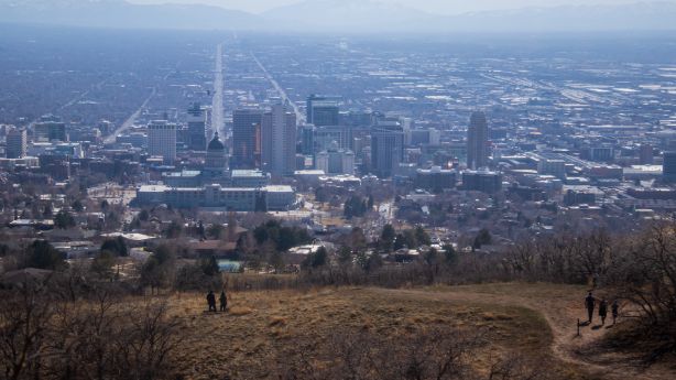
SALT LAKE CITY – Another record temperature was set in Salt Lake City on Monday, but a storm this week is about to cool things off.
The National Weather Service reported that it hit 69 degrees Fahrenheit at Salt Lake City International Airport, the city’s previous record high of 68 degrees set in 1972. The city also set a record on Saturday when the temperature at the airport reached 70 degrees.
These late spring temperatures won’t last long, however, due to a storm system expected to drop 20 degrees cooler than in recent days along the Wasatch Front. The area is also expected to have some rainfall, but nothing like the February storms.
Temperatures will cool down significantly if a cold front from the west pulls through at some point late Monday evening or early Tuesday morning. It is being propelled by a storm system off the coast of the Pacific Northwest, said KSL meteorologist Brett Benson.
The initial cold front is expected to bring some showers, but not very much. The National Weather Service forecast light snow and rain overnight for areas in northern Utah. There is also expected to be light snow and rain in northern and central Utah on Tuesday and Wednesday.
The agency tweeted a graph Monday afternoon showing the storm could deliver up to 3 to 4 inches of snow in high altitude areas like Alta, Ben Lomond, the Pavant Mountains, Tony Grove and the western Uintas. Some other high altitude areas could gain an inch or two between Monday evening and Wednesday morning.
Piles of snow in the mountains are expected here by Wednesday morning. Additional light accumulations of snow are likely to be later Wednesday through Friday. # Utwxpic.twitter.com / Uqvh0Dw4QM
– NWS Salt Lake City (@NWSSaltLakeCity) March 8, 2021
The Pacific coast storm is expected to move south towards California before moving east and reaching southern Utah sometime around mid-week, Benson added.
The National Weather Service also tweeted on Monday that this storm system is currently forecasting light mountain snow and valley rain between Wednesday and Friday. Most of it will revolve around southern and central Utah.
“Once that cold front takes hold (Monday night), it will remain restless here in northern and central Utah for the next few days,” said Benson. “Then the main part of the storm system rolls through on Wednesday. That mostly affects southern Utah, but we have also seen a few showers in northern Utah associated with it.”
Thermometers will capture the more notable effects of the incoming storm system, though they will only bring temperatures back up to normal for that time of year.
For example, Tuesday’s high for Salt Lake City drops back to 48 degrees and will stay in the top 40s for the rest of the week, according to the National Weather Service. The lows are expected to be between 31 and 37 degrees.
According to the climate book of the Weather Service for Salt Lake City, the average high is 52 to 53 degrees with lows of 32 to 33 degrees.
In the meantime, the agency is forecasting highs in Logan between 42 and 45 from Tuesday to Friday. The night lows are expected to be in the 20s on those days, with temperatures as high as 21 degrees on Friday.
Richfield’s highs will drop to a high of 54 Tuesday from the upper 60s on Monday, before falling to a high of 42 Thursday and Friday, according to the Weather Service forecast. St. George, on the other hand, will move the rest of the work week from Monday in the mid-1970s to Tuesday in the mid-60s and the rest of the work week in the mid-50s, the weather service added.
The storm is not expected to provide anything essential to fill in the precipitation gaps that have grown after the last winter storm. The federal SNOTEL report shows that Utah snowpack has fallen back to nearly 75% of its average this time of year.
The weather service’s Salt Lake City station is also negative for both the water year 2021 and the calendar year. On Monday, the weather service data showed it was 0.26 inches below normal for that point in the calendar year and 3.33 inches below normal for the water year that began October 1, 2020.
For a full 7 day forecast of Utah locations, visit the KSL Weather Center website.
A “relatively dry, relatively warm” winter
The meteorological winter ended on February 28, and the National Weather Service determined that it was a “relatively dry, relatively warm” spring. The agency released preliminary data on Saturday that was recorded in Utah from December 1, 2020 through February 28.
The lowest temperature recorded in Salt Lake City in the three months was 16 degrees. This is the warmest measured minimum temperature for the winter season. The average temperature for Salt Lake City during the winter season was 33 degrees, which was nowhere near the record high of 38.3 degrees between 2014 and 2015. However, it was above the normal value of 31.3 degrees.
“Interesting Record”
The winter of 20-21 was relatively dry and warm. Some notes:
?️Salt Lake City’s lowest winter temperature was the warmest in history (never below 16)
?️Logan’s lowest minimum temperature stayed above 0 (unusual) during the winter # utwxpic.twitter.com/f3lgtUyAwL
– NWS Salt Lake City (@NWSSaltLakeCity) March 6, 2021
The city’s 2.94 inches of rainfall during the season was also below normal of 3.91 inches. This is despite the fact that the city broke a record for the most snowfalls in February. More than half of the winter snowfall recorded during the season occurred in February.
Data shows that above-average temperatures during the season were reported primarily in western Utah. For example, the agency tweeted that Logan’s minimum minimum temperature was 5 degrees, which was “unusual”.
In many areas in eastern and southern Utah, temperatures were slightly below normal. Aside from a few pockets in the northwest and central Utah, most parts of the state experienced below average rainfall.
×
Comments are closed.